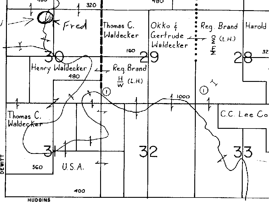
Here is a map showing the land in South Dakota previously owned by the Waldeckers. The single-sided arrows indicate the lands connected by them belong to the same person. I put a circle with “Fred” pointing to it. At the time this map was made, Fred and his family no longer owned this land. I only inidcate more or less where he place was at one time. The designation “USA” means government pasture. You can see that Dad owned most all of the “boot,”–all but a slice in the middle that was owned by the government. Notice that the map indicates the registered brands of Henry and Okko. On this map Dad is said to own 720 acres (560+160). Henry owns 480, and Okko owns 1,000.
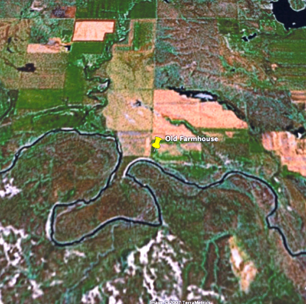
You can see this same area from this sattelite view. Notice the boot-like shape of the river that runs through the land. The farmhouse was situated at about 2200 feet above sea level. It was about 7 miles to the Shadehill dam (straight line) and about 14 miles (straight line) to Lemmon. Following the roads to Lemmon was about 20 miles.
{ 10 comments… read them below or add one }
I don’t see the map
I see the map and the arial. Cool!
Awesome! It is 6 a.m. here and I haven’t gone to bed yet. I am finishing some homework for electromagnetism. I think I am rather slow, but stubborn when it comes to problem-solving.
That is awesome! I want to go back! I had not remembered it was a “boot” where Poppop owned the land.
Oh Seth!You must get your sleep!
I see it now – neat!
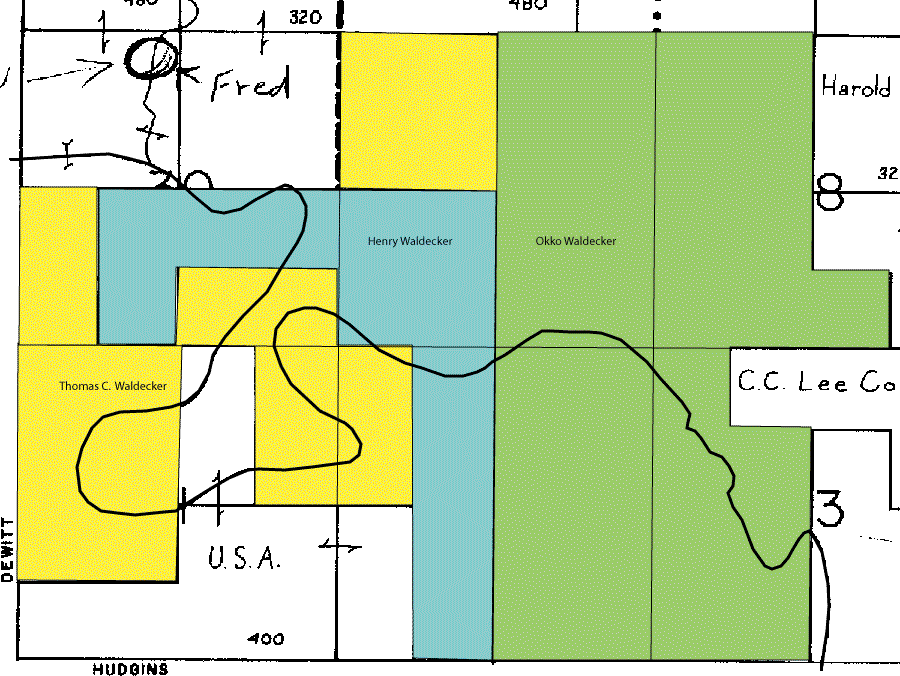
I added a color-coded map to help with the visual clarity.
wow, the colored map is very helpful, thank you, Daddy.
I don’t see a very good boot. Do you mean the lobe in the lower left corner of the map?
That would be the “toe” area.